The Arctic Experience
From the northernmost border of Finland starts Kirkenes region in Norway. In Kirkenes visitors have an opportunity to experience the amazing Arctic Ocean, mountains carved by the ice age, and exciting king crab safaris around the year. During the summer under the midnight sun and in the winter under the northern lights. Other popular activities in Kirkenes region are river boat trips, snowmobiling and husky sledding. A night in Snow Hotel Kirkenes is once in the lifetime experience!
Kirkenes region located on the shores of Varanger fjord has several unique destinations: Kirkenes town, Bugøynes village, The Pasvik Valley and for example the villages of Neiden and Grense Jakobselv.
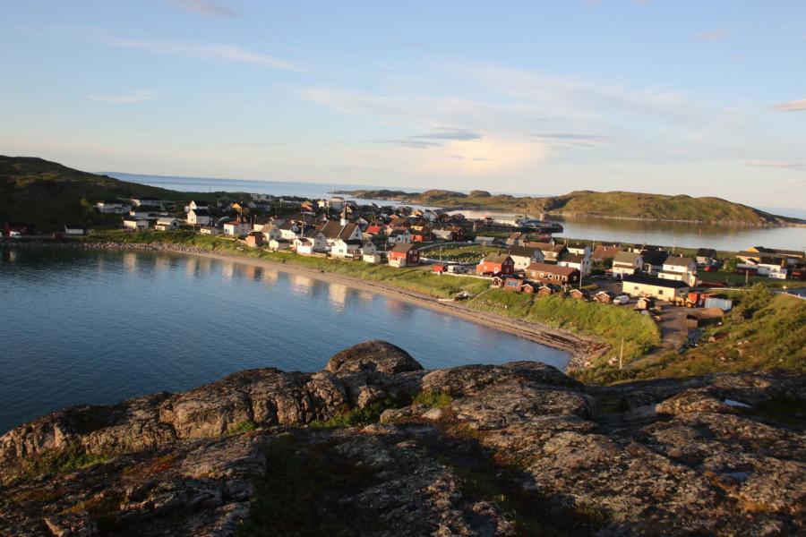
Bugøynes is a beautiful little fishing village and a center of king crab fishing. Have a taste of the Arctic Ocean delicacies in popular Bygøynes Bistro. The world-famous Barents Sauna is also located in the village by the shoreline. Enjoy the gentle warmth of the sauna and dip your toes or swim in the Arctic Ocean.
The 100-kilometre long Pasvik Valley has several protected primeval forests and wetland areas which make the flora and fauna there unique and diverse.
Neiden is the center of Skolt Sámi culture in Norway. Visit The Skolt Sámi Museum in Neiden and learn about the indigenous history of Kirkenes region.
The Grense Jakobselv is the easternmost fishing village in Norway and King Oscar II’s Chapel is worth visiting during the arctic summer. On the way to the village, you will pass the oldest mountain range of Norway.
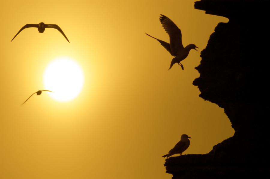
In the Varanger fjord area you can find bird nesting cliffs rising from the sea, authentic fishing villages and rugged highlands.
Bugøynes
Bugøynes is a beautiful fishing village situated approx. 100 km west of Kirkenes. As the village was not burnt by the Germans during World War II, many old buildings are preserved. Bugøynes has strong cultural influences from the many Finns who migrated here in the late 19th century, and is often referred to as “Little Finland”. Bugøynes is a centre in Norway for the commercial fishery of king crabs, which are exported live around the world.
How to get there
It is 100 km from Kirkenes to Bugøynes. Follow the E6 towards Tana. After 80 km turn right (signposted). 20 km more and you are there.
Activities in Kirkenes region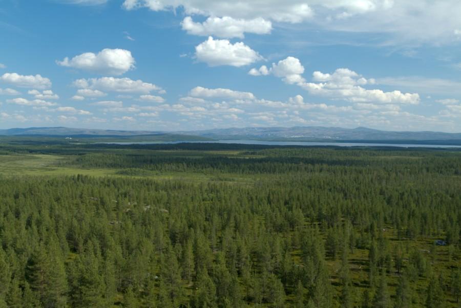
The Pasvik Valley
Close to the borders of Norway, Russia and Finland, the Pasvik Valley (Pasvikdalen) stretches south of Kirkenes to the Three-country cairn (Treriksrøysa) in the south. The 100 km-long valley has large areas of pine and birch forest, as well as several protected primeval forest and wetland areas. Pasvik has a rich and diverse flora and fauna, and is known as the meeting place for species from east and west. Norway’s densest brown bear population lives in the valley, while more than 220 bird species have been observed here. The Pasvik River runs through the valley forming the border between Norway and Russia. The river continues south through the Øvre Pasvik National Park to its source, Lake Inari in Finland.
How to get there
The easiest way to reach the Pasvik Valley is by car or bike. Follow the E6 highway to Hesseng and then take route 885. This road leads 100 km up to Nyrud passing farms and small villages along the way. You will find places to stay at Svanhovd, Melkefoss and Vaggetem.
Neiden
Neiden is a fascinating small village situated near the Finnish border approx. 40 km west from Kirkenes. The people in Neiden have their history and origin from Skoltesami. Neiden, which lies along the Neiden River, consists of two villages: Neiden on the Norwegian side and Näätämö on the Finnish side.
How to get there
Neiden is located along the road E6.
Follow the E6 towards Tana 40 km from Kirkenes.
Grense Jakobselv
Grense Jakobselv is a green valley 60 km east of Kirkenes. In the river runs the eastern border and on the way there you drive past Norway’s oldest mountain formation. This is a popular tourist spot during the summer months, and is a perfect place to experience the summer in the arctic.
How to get there
From Kirkenes, follow the E6 to Hesseng. At the roundabout, follow the road towards Russia E105. At Storskog, turn left and follow road 886 to Grense Jakobselv. The road is signposted completely from Hesseng.
The road is closed for the winter from Vintervollen (30 km before Grense Jakobselv) from Oct – May. In winter only accessible by snowmobile.
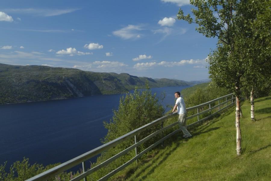
Varanger
In the far north and as far east as you can go in Norway, where the sky meets the sea, lies Varanger, bathed in the midnight sun and the northern lights of winter. Here the wild landscape meanders through bird-nesting cliffs, fishing villages, and rugged highlands – out to the end of the world.
Nature offers rivers teeming with fish, snow-clad plains, exotic king crabs, birds breeding in spring, leaping salmon, the shining sea, and dancing northern lights. People and traditions make Varanger an Arctic melting pot of communities and cultures. Varanger is a different experience. Scenery and settlements, the light, the colors, the lofty sky and wide horizon, exciting activities – and the open people.
How to get there
It’s possible to drive all the way to Varanger, regardless if you come by car, mobile home, or motorcycle. The European route E6 runs through the region and ends in Kirkenes, close to the Russian border.
All roads are open year-round, but some passes might close for short periods in winter.
Part of the northernmost roadtrip
Must visit in Kirkenes region
Borderland Museum in Kirkenes
160,000 soldiers, 10,000 civilians, 1000 air raid sirens and 328 air raids: the theatre of war in Sør-Varanger during the Second World War was played out on a grand scale. Everything is explained at the Borderland Museum (Grenselandmuseet) in Kirkenes, with an emphasis on how people experienced the events as they unfolded.
Waterfall “Skoltefossen” in Neiden
Skoltefossen is located in the middle of the village. The road E6 crosses Neidenelva. Park by the bridge and go to Skoltfossen which goes right under the bridge. If you are lucky you can see the salmon on their tour upstream (June-Aug).
Skolt sámi Museum in Neiden
The museums permanent exhibition The Skolt Sámi Land is a historical journey. It consists of 300 objects exhibited over 200 sqm. The exhibition area is divided into three rooms: The People, The Land and The World. Each room offers a different perspective and insight, and together they aim to tell thecomplex history of the Skolt Sámi’s.
St. George’s Chapel in Neiden
The tradition tells that the monk Trifon built chapels in the Pasvik and Neiden Siidas in 1565. The existing building in Neiden was named St.George’s chapel and is probably a few hundred years old. Inside the chapel there is an altarpiece, an altar and several icons.
Svanhovd in Pasvik Valley
A popular destination for unique experiences in the Pasvik Valley. Here, you find the Visitor Centre for Øvre Pasvik National Park, Botanical Garden and Conference Centre.
The Visitor Centre has an exhibition about the unique environment, culture and history of the Pasvik Valley and one can learn more about the virgin forest in the National Park and the most distinctive bird and animal species that live here.
Height 96, Border observation tower
If you continue 6 km south of Svanvik along route 885, you will see an old border observation tower on a small hill by the road. From the top of this tower, there are good views of Pasvikdalen. There is a mini café with souvenir sales during the summer months.
Øvre Pasvik National Park
The Park has Norway’s northernmost primeval forest, and the national park is a mosaic of old-growth forest and water. The area is located in the northwest corner of the Siberian taiga. Here are eastern species that do not occur elsewhere in the country. A walk to Treriksrøysa and Ellenvanskoia is popular. For more info contact the Visitor Center for the National Park.
Beach at the Barents sea
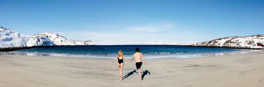
Where the road ends you will find a parking lot and incredibly nice views of the Barents Sea. If the weather is clear, you can look over to the Varanger Peninsula. The midnight sun can be observed here in the evening so we recommend this as an evening trip or overnight trip. If you are really lucky you can see Beluga whales. You are guaranteed a great nature experience with lots of wildlife and many different bird species. Bathing is recommended even if the water rarely has more than 10 ℃